Northwest Atlantic Fisheries Management Divisions
Map of the Northwest Atlantic Fisheries Management Divisions
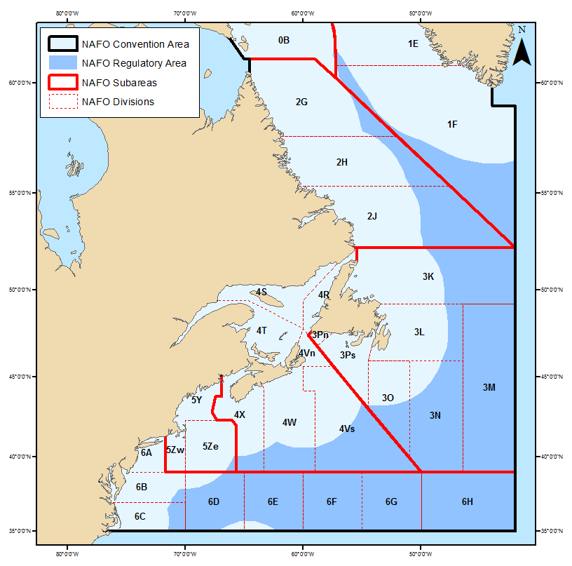
The northern cod stock is considered to extend from Hopedale in southern Labrador to the northern part of the Grand Banks. This area, known as NAFO divisions 2J3KL consists specifically of:
- Division 2J
- That portion of the sub-area lying south of the parallel of 55 20 north latitude (Hopedale).
- Division 3K
- That portion of the sub-area lying north of the parallel of 49 15 north latitude (Cape Freels, Newfoundland).
- Division 3L
- That portion of the sub-area lying between the Newfoundland coast from Cape Freels to Cape St. Mary and a line described as follows: beginning at Cape Freels, thence due east to the meridian of 46 30 west longitude, thence due south to the parallel of 46 00 north latitude, thence due west to the meridian of 54 30 west longitude, thence along a rhumb line to Cape St. Mary, Newfoundland.
(NAFO Handbook 1991)
Canada is responsible for the management of northern cod within the 200-mile limit. This limit was declared by Canada in January of 1977. Areas of concern which fall outside the 200-mile limit and under NAFO jurisdiction consist of:
- the Nose of the Grand Banks (3L)
- the Tail of the Grand Banks (3NO)
- the Flemish Cap (3M)